Day 1
George to Jeffreys Bay
We left Oudtshoorn this morning at 8am heading towards George to pick up the bikes. We had to drop off the rental car as well, so that and the backing of the panniers meant we only left George at around midday. I must say that the people at Lynn Schroeder BMW was excellent and they gave us excellent service. As we pulled up to the dealership, we saw the two bikes parked in front and I immediately put dibs on the white one. Well, at first I thought they couldn't be the bikes as the one was brand new. The story was that someone bought one 800GS the previous week to go to the Buffalo Rally, so they had to replace it with a brand new bike.

Just before we headed off, we switched on the intercoms and realised that they didn't connect properly. He could hear me, but I couldn't hear him. All the other functions worked okay. What a pain. My wife bought the set for me as a Christmas present, especially for this trip and now they don't work! This really put a damper on the trip as we really enjoyed chatting on the long roads and I wanted to tell him a bit about the areas we go past.
Our first stop was just outside of George at my old Uni where I studied forestry. I just wanted to show Brien around really. We stopped by the house on campus I lived in with my wife after finishing college.
 |
Our house on campus when I worked here back in the day.
|
We then hopped onto the old George-Knysna road or Seven Passes Road, because it's pretty much a string of passes crossing several rivers along the way. This was the main road between Knysna and George for a long time and better maintained with proper bridges. The wooden bridges have been replaced with concrete bridges around 1900. It was built by Thomas Bain, probably one of the best known South African road engineers. He completed this 75km road with the assistance of his brother-in-law, Adam de Smidt, between 1867 and 1883. The pass used to have an old toll house (Pampoenkraal Toll) just outside the Saasveld gates, but this was removed in 1958.
Today the first bit is sealed and then turns into a farm road at times but it also has sections where it dips and roses in and out of valleys.
 |
The old George-Knysna road is just littered with these old bridges, dating between the late 1800's and the very early 1900's. Not that old, but they're all single lane and still in good condition.
|
The bikes had different tyres on as to what we expected. We were told we'd get Conti's, but we ended up with a set of Mitas E-07's. At least the E-09's or E-10 would have been better, but then again I haven't tried those either. I know everyone raves about them, but I'm not convinced yet. They haven't really impressed me. Both Brien and I really struggled for grip on these roads and I think it was pretty much a combination of the tyres and the road surface. The unsealed roads where all packed with a thin layer of loose gravel on top, making it quite hard to get traction. On the slightest bit of acceleration the back end would break away. The weight from the panniers also meant that we had less traction on the front wheel and it constantly felt like it wanted to lift. Anyway, I enjoyed the scenery and and we soon ended up in Knysna for a bit of late lunch at the Waterfront.
 |
Knysna Marina and Waterfront.
|
Knysna was founded because of the timber industry (which is now pretty much just plantation forestry) and gold mining. The gold's gone, but the plantations are still going. This is where I had my first job in forestry. I'm also really relieved that we're not harvesting the indigenous forests any more. It was an insanely destructive practice and the Southern Cape has lost most of its forests in the process. Now it's heavily protected and only very limited selective felling takes place to keep the forest healthy.
 |
Absolute carnage.
|
 |
Gold fever struck and suddenly there were loads of people flooding to the region. After the rush died down, there were several towns that turned into ghost towns of which a better known one is Millwood where the Bendigo Mine was located.
|
 |
A 2 foot rail train network was built to transport timber from the forests to the Thiesens Mill and the harbour in Knysna.
|
I took Brien to the Knysna heads just to see the view out over the ocean and back towards Knysna. A spectacular spot.
 | ||
This entrance to the Knysna estuary has been the main ship access for several hundred years and it's also seen it fair share of shipwrecks. As a matter of fact, the first Carstens to come to South Africa was a ships Captain and helped ship timber from the Knysna forests through these heads (for shame!).
|

 |
A sheer drop of a few hundred metres behind that railing.
|
It was just a quick stop as we had to get going so we could make it to Jeffreys Bay in time. We took the N2 all the way, past Plettenberg Bay and out towards the Stormsriver Bridge. I didn't do the bungee in the end. I'm really not sure whether I would have done it, even if we had time.
We also stopped off at one of the area's big trees. It's an 800 year old Outeniqua Yellowwood. It's 35 odd metres tall and quite a beautiful specimen. It was quite a nice stroll through the forest and Brien was starting to question my motives with taking him for this little romantic walk.
 |
Outeniqua Yellowwood (Podocarpus falcatus)
|

There are even bigger ones than this.
 |
Some of the larger logs being cut up in the field, before loading them to either ox wagon or the train. Mainly pit sawing was used just because of the sheer size of the logs.
|
After this we pretty much motored it to Jeffreys along the N2. We were worried at one point, thinking we might run out of fuel as we haven't filled up all day. The electronic fuel gauge is a bit confusing and gave us very inconsistent figures, so it was quite hard to figure out how far we could still go. Luckily we made it to the service station in Humansdorp. From there is was a quick hop to Jeffreys.
We both had issues with the front wheel starting to wobble and snake at higher speeds. Not sure why this is happening. Might be the tyres or the weight of the panniers. Our rear ends were also hurting after this ride as I swear these seats were made by the CIA or MI5 for some sort of sadistic torture method and they decided it was too cruel and gave it to BMW.
 |
Two of the dogs at the accommodation in Jeffreys Bay. What can I say? I love animals.
|
I've sort of gotten used to the indicators now... I know that sounds a bit random, but we really struggled with them during our test ride here in Melbourne. Different to normal indicators on bikes, they have a switch on each handle. The angle is also weird as you have to almost lift part of your hand off the handle and on the throttle grip, this can cause you to rev the bike and make it jump by accident.
Tomorrow it's off to Oudtshoorn via Baviaanskloof. I'm looking forward to that, but I know it's going to be tough.
Day 2
Jeffreys Bay to Oudtshoorn
A leisurely start to the day. We walked to the nearest Wimpy for a brekkie and then down to the beach. Very romantic. I'm starting to have my doubts about Brien's motives with this trip! Jeffreys Bay is famous for it's world class surf spot, Supertubes, which is part of the ASP tour. The beach was great, aside from the odd dog turd here and there. Wide open, soft, sandy beaches as far as you can see. Sounds like an ad, but it's true.
 |
J'Bay beaches, with a curious teepee shaped building in the back.
|
 |
Quite nice, but I must say that parts of it are a bit run down. Nothing terrible, but not how I remember it to be.
|
We hopped into the nearest surf shop for a J'Bay t-shirt and some directions. We wanted to slightly alter the course to go past Hankey and Patensie, because I got a bit worried about running out of fuel along Baviaanskloof.
 |
Quick fuel stop before tackling Baviaanskloof.
|
The Eastern Cape rural areas are a lot more like what I think foreigners expect South Africa to be like in terms of communities. We went past a couple of settlements for some photo ops. The people were really friendly, waving at us, old and young, heads turning. The road went into a canyon or kloof, turning to gravel. The scenery immediately spectacular.
 |
And we're not even in Baviaanskloof yet.
|
We soon arrived at the gate to the Baviaanskloof nature reserve, signed in and cruised through. The first thing I noticed was the sign saying 'This road is not suitable for trucks, caravans and sedans'. The next one said 'Give way to animals'. The speed limit was 40km/h and that suited me as I just wanted to cruise and have a good look around. We very quickly started climbing upwards and behind us, there were some amazing views over the valleys.
 |
The view back into one of the valleys.
|
 |
One of the steep claims. Luckily the roads were in great condition and we didn't have any issues at all.
|
 |
I was going for a slash and Brien decided to guard the bikes, doing his best palace guard march impression, less the fury hat of course.
|
 |
No safety railings next to those drops! On that, I read a story about an adventure rider who recently died here after travelling on his own and dropping off one of these cliffs after allegedly being forced off the road by car ending up on the slope. He had bad head injuries and was there for something like 15 days, dying of starvation and exposure. He managed to make it up the hill at one point, setting his bike alight to attract attention, but later fell down the slope again.
|
We eventually reached a height of 1680m according to Brien's GPS. It had a bit of a plateau before dropping down into another valley. This time the road had the wheel tracks cemented up to help with traction. They're great to help with traction, yes, but it can go wrong if you drop in between them as these sections have quite a bit of erosion.
In the valley we took a break in a wooded spot. We haven't seen any water yet as all the crossing were just dry river beds. It was now around midday and when a couple in an old Pajero passed us they told us the road ahead will get a bit rough. It sounded like another 3 hours to Willowmore, where we'd be able to fill up. This was a bit of a change to our original plan to go to Uniondale.
 |
Taking a break in a small wooded area and chomping away at the dried fruit and some Powerade.
|
After the break we headed through the valley and it wasn't too long before we got to some river crossings and not one, but several of them. A mix of sand, round river stones and some cement slabs here and there. The water levels were just right. Enough to cool down and deep enough to make it technical, but not too deep to make it frustrating. We came through some forested areas, mostly just the thorn trees and some other Acacias. I scared some Brown Eagles out from trees as I was going through a wooded patch, I had two Kudus jump out in front of me, and later a small Bush Buck. The road through the nature reserve took us about 3 hours.
Bad news though, I dented my front rim. I came out one of the river crossings and hit a a rock the size of my fist. I didn't see it until it was a couple of metres in front of me. Brien hit a rock, so hard that his bike lifted, but there wasn't even a little nick on the rim. The technician from BMW ways it's all good. We can easily continue on the trip without having to repair it. Luckily they've got tubes, so it won't deflate the tyre.
 |
My first battle scar. Luckily the dent didn't affect the wheel balance.
|
 |
Taking a couple of minutes to rest at some ruins just after leaving the Baviaanskloof Nature Reserve.
|
 |
A river crossing on the way to Willowmore. Looks really docile, but it had a surprise at the end, when the cement slabs suddenly takes a dip and you drop another 20cm or 30cm lower, spraying you completely wet. It was a hot day and the water was welcome, but still a surprise. By the way, I saw loads of Vervet Monkeys in the tree at the end of the river crossing.
|
The day gave me a lot more than I anticipated, but it was well worth it. We did have to then gun it on the farm road to Willowmore. Luckily the roads were long, open gravel roads and we could give it some gas all the way to Willowmore.
In Willowmore, we met another group of bikers at the service station. They had a range of adventure bikes, including KLR, 990 Adventures, F800, R1200 and an HP. We filled up, took a breather and gunned it to Oudtshoorn via De Rust. Brian went right over a Cape Cobra, which immediately lifted its head, just as I passed by about a metre away. Not too long after that he almost got hit again, this time by a bird flying out from a bush and right at his head. Looks like nature's out to get Brien.
We got to Oudtshoorn at about 6.
What a great day. I really enjoyed it. Bring me more of this.
It was only after we did the trip that we read about a very well known and respected South African adventure rider who died on Baviaanskloof not too long before we were there. He was reviewing a bike apparently and got forced off the road by a car, went down a slope and received serious head injuries. He managed to get up the slope at one point to set his bike on fire to attract attention, but fell down the slope again. He only had his camel back with about whatever was left of the 2 or 3 litres in it. They only found his body 15 days later. He died of exposure and dehydration. One thing you can learn from this is that you don't go riding on your own in remote areas. I just won't take that risk.
Day 3
Oudtshoorn to Merweville
We started late today, about 10am. We stopped off at an ostrich farm just outside Oudtshoorn to say hi to my dad and have a look around.
 |
In the middle is my dad's right-hand, George. He's moved from farm to farm with my dad and one of the most loyal and hard working people my dad's ever had as an assistant. He doesn't speak English at all, so there was a lot of blank faced looks directed at Brien.
|
 |
Ostriches rounded up for injections.
|
 |
Dad, can I get one of these to ride instead of the BMW? I'm sure they'll make great adventure machines.
|
 |
A strange bird, no matter how you look at it.
|
We then made our way to the Swartberg Pass, just to the north of Oudtshoorn. It's quite an old pass, curling up the mountain and dropping into a valley at the back, and ending just outside of Prince Albert. Yes, I said Prince Albert, but no, it's not where the name for the item of man jewelry originates from. Originally called Albertsburg, rename in honour of Prince Albert of Saxe-Coburg and Gotha (husband of Queen Victoria). It's a great little town, beautiful and quiet. Several coffee shops down the main drag (which is most of the town) and the old Swartberg Hotel.
 |
No Brien, luckily this hasn't got anything to do with your jewellery.
|
Anyway, I'm getting ahead of myself. The Swartberg Pass was great. It started off as a bit of a loose gravel mess, but as we got to the top it got better. We saw some spectacular views at the top, looking out over the Little Karoo and north into the valleys and gorges of the Swartberg.
 |
The landscape below is spectacular. The photos don't give it justice. It's an amazing view...and about to get better.
|
 |
The road so far was a bit dicey as it's covered with loose stones, but nothing difficult. I'm starting to get used to this now and the way the bike handles it too.
|
 |
The old toll house for the Swartberg Pass.
|
 |
The retaining walls on this pass are still original and more than 120 years old!
|
 |
We took a quick stop. It was a freezing cold wind blowing over from the south, so we didn't stick around for long. This area gets a bit of snow in the winter and is probably the coldest bit of this whole region.
|
The northern side dropped down past cliffs and next to deep gorges. All the way the handy work of engineers several generations back could be seen in the walls and barriers skirting the roads. We also went past a couple of old dilapidated buildings built with pure stone and probably minimal mortar if any. I'm assuming they used to be the old toll houses or rest stops. We also passed a building that said 'Jail' in brackets. Not sure if this was maybe a jail for prisoners of war involved with building this pass. I know they used Italian prisoners of war for some of the passes during the second world war.
 |
The northern side of the pass goes through a massive gorge providing for some towering cliffs. The Western Cape's geography is just so dramatic. Love it.
|
 |
One of many geological sites along the road through the gorge. We've got to many photos to show them here and you also can't stop that much, otherwise it turns into a photo shoot as opposed to a bike ride.
|
We got out the other side of the pass and headed into Prince Albert for lunch. The Swartberg Hotel did the trick. Good selection. I had breakfast from the all day breakfast menu. What can I say, I like breakfast. Brien said the town is almost too quite for him. He's getting way too used to the noise of the city. We sat there, just chatting away about nothing much. It was really relaxing. The hotel is an old building with wooden floors and really nicely decorated. I wouldn't have minded spending a couple of nights there. We hopped into the information centre to find out about blockhouses in the area and got directed to Leeu-Gamka. There is also supposed to be a grave of a British solder nicknamed the 'tallest solder'. She didn't know where exactly it was, but said we should just ask people there.
 |
Prince Albert's main drag.
|
 |
The Swartberg Hotel in Prince Albert.
|
That done we hopped on the bikes and took an unsealed road towards Leeu-Gamka on the N1. This is a where I had my first ever spill. Quite a silly one, but a spill nonetheless. I came up to a corner and there was a large patch of sand right in the middle of it and I realised I wasn't going to make the turn, not being able to throw the bike into the sand for fear of losing control. All I could do was pile on the breaks and hope I could stop before I reached the edge of the road. I sort of did, but when I got to the berm, I was going about 5km/h and just couldn't keep the bike upright as I hit the berm and I toppled over. I wasn't hurt and the pannier and Barkbusters had some minor scrapes on, but aside from that, all sweet. Brien had to take shots, but overall he was quite sympathetic. We took a couple of minutes to get the adrenaline down and then got back on again.
 |
My first off...in 16 years. The last time I got knocked off the bike by a drunk driver in a hit and run. This time it was sand.
|
When we got to Leeu-Gamka, we filled up and I asked a cop who happened to be filling up as well, where the Blockhouse was. He gave us some directions and we headed out towards it. I was surprised that it wasn't marked with signage, as this is surely a tourist attraction. It was a bit dilapidated with vegetation growing inside it, but still standing and you can't help but let your mind travel back to those years, where this was the scene of so many deaths. We couldn't get inside as it only had one door and that was on the second level. They must have had a ladder which they pulled up when under attack. We asked people from the houses close by where the grave of the British solder might be, but they didn't know and guessed it might be in the town grave yard, but we didn't find it there either. I'd love to find out more about this. I found out later that he wasn't a British solder, but actually the first Australian solder to die in the war. Private Schultz, of the 3rd Battalion, Grenadier Guards was the tallest solder in the British army, at almost 7ft. The cemetery was just around the corner at the train station, which was used as a hospital during the war and the buildings are still standing.
 |
A more solidly built Boer War blockhouse (1901) guarding the rail line and bridge.
|
The name Leeu-Gamka originates from the two river that joins here and this spot used to be used as an overnight spot for travellers during the early settlement, gold and diamond rush and Boer War. The rivers are almost always dry, but there is sufficient ground water, although brack. There were frequent attacks from Bushmen and wild animals. Apparently this area was teaming with lions and attacks were common. At the time, the Cape Lion was the dominant species, but it became extinct in the mid 1800's. This area seems like nothing much today, but it has an incredibly rich history. Go read up about it.
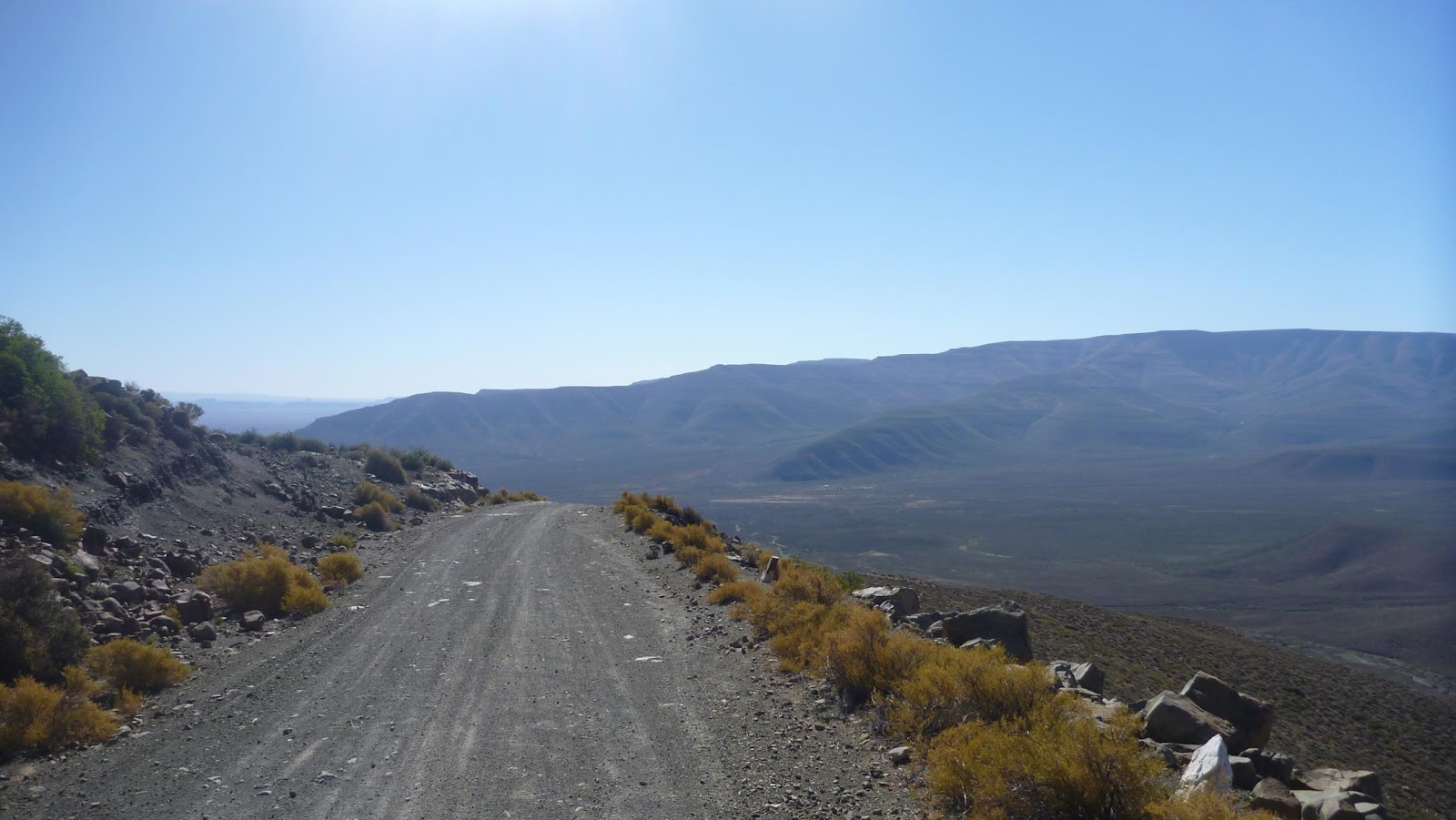
All this done, we took the sealed road out to Fraserburg and then got onto the unsealed road to Merweville. That section on the sealed road was mind numbingly boring! We started amusing ourselves by doing tricks on the bikes. Hey, that's what you start doing on a boring road when you have nobody to talk to. Luckily this only lasted for 40km, before we turned off onto the unsealed bit to Merweville. This section was again a nice open and fast gravel road, with good grip, if you kept in the tracks. These Mitas tyres are a challenge though. As soon as you end up on the islands between the tracks, the front wheel just starts weaving. At 120, that's not what you want really. We made it to Merweville in good time and and pulled into the gate at the Springbok Lodge at 1530. I took a shower an relaxed with a cold beer, sitting outside, getting eaten alive by the mozzies
 |
Merweville's main drag. A lot of South Africans don't even know this town exists.
|
 |
Springbok Lodge in Merweville, our stop for the night.
|
 |
A communal area at the B&B.
|
 |
Catching up on the writing and getting eaten alive by the mozzies.
|
 |
The braai (BBQ) area.
|

The braai.
 |
Here you can start your fire and just laze around it or put a potjie (cast iron black three-legged pot) on to simmer away.
|
 |
We were told to park the bikes inside the compound. They have adventure bikers here quite often and they look after them well.
|
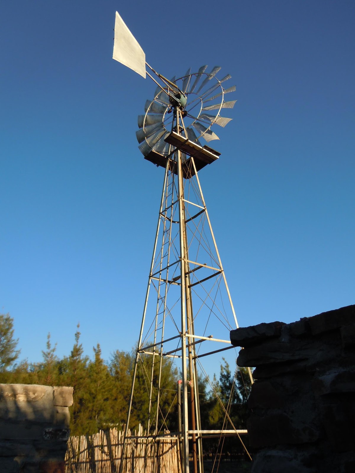 |
The wind pump supplying the ground water to the house. They have running water, but obviously have extra water needs.
|
 |
The town church. One thing you have to realise and will realise very quickly when you arrive in South Africa, is that South Africans are very religious. Every town has a church and very high percentage of the population is Christian.
|
 |
The Springbok Lodge entrance.
|
 |
An old ox wagon, probably still used in the early 1900's.
|
Overall, today was a really nice ride. I enjoyed it. I'm not tired or aching, except for my shoulder blade, where I think I might have pulled a muscle yesterday. I'm doing okay and so is Brien. Looking forward to the rest of the trip. Tomorrow night it's Calvinia.
Day 4
Merweville to Calvinia (~ 438km)
 |
For some reason I couldn't get Google to display this trip. Probably because we doubled back and crossed over tracks a fair bit.
|
Today went pretty well, mostly. We left Merweville after a good breakfast. I must recommend Springbok Lodge to anyone interested in visiting the Great Karoo. Wonderful hospitality and good home cooked meals. We also had the option of getting a BBQ pack, which we could braai (barbeque) ourselves. I thought the home cooked meal would be interesting for Brien. He really liked it so that worked fine.
We headed out some well maintained municipal roads towards Sutherland. As we approached the mountains to the north, the road turned into a farm road and we had to start opening and closing gates.
 |
Some great river crossings here and there.
|
We worked out a good system where the first rider would open them and the second would close them. We've had to start riding apart as the dust has just become to much. The views from the top of the pass was just amazing. It makes you feel small and insignificant.
 |
Some spectacular gorges and cliffs al through the mountains and passes in the area.
|
 |
Those pesky gates, but we had them sorted. Our system of riding fairly separated to minimise kicking up dust onto the other rider, worked with one opening the gate and the second one closing it, so you don't have to get off the bike twice at the gate.
|
 |
The views from the top of, what I think is, Rooiberg Pass. From here we passed into the Northern Cape for the first time.
|
 |
One of the farm house compounds along the route. Brien's constantly amazed that anyone can live so far away from civilisation. I would actually prefer that to some extent.
|
We continued with this road until we joined up with the road from Laingsburg, after which it improved to a municipal grade road again.
 |
The last section of road towards the R354. Some really tricky and sandy sections. I had a couple of heart stopping moments, but all good.
|
It was still tricky though as there were several sections of sand and ruts. Several river crossings caused issues as we had to slow right down to not hit the edges of the slabs or damage wheels on the deep furrows from the rain they had here recently. The flood damage was evident everywhere. We also got to see more antelope jumping across the road. We finally reached Sutherland. This was a slight change to the schedule as we thought we'd get something to eat and maybe head up to the observatory, which we did.
 |
One of the older buildings in Sutherland. I don't know for sure okay; it just looks old.
|
 |
Sutherland's main drag. Brien kept riding over the one stop sign in the middle. I don't blame him though.
|
We got a tour of the Southern African Large Telescope (SALT) telescope, which is absolutely mind boggling. The site has several other smaller telescopes from different countries and are almost all remotely controlled from those countries with only some maintenance teams on site. The guide was really knowledgeable and we even got to see some tame Springbok walking around the sight. Apparently the area doubles as a nature reserve.
 |
Unless you can see faraway galaxies through your hand, I guess you can't sell that patent.
Some of the smaller telescopes behind Brien belong to other countries and projects.
|
 |
The SALT telescope. A serious piece of engineering.
|
 |
The guide on the right and the SALT telescope in the back on the left. It's tiny...
|
 |
A herd of Springbok showed up when we came out of the SALT telescope.
|
We also got to see the British graves from the Boer war, just on the edge of town. It must have been terrible to go to another country, so far away, never to go back home again. Especially thinking of the families back home who might or might not find out of your demise. We also noticed that some of the graves date from King Edward's rule and some from Queen Victoria. Something interesting is that there is one soldier here who was buried twice. He drowned in a flash flood and after he was he was awarded a posthumous military cross, which was placed in the graveyard. The soldier's name was Burnett, but I don't know more than that.
 |
Burnett's first grave.
|
 |
Burnett's military cross, not too far from his grave.
|
I also heard that there were some blockhouses in the area, one on the hill overlooking Sutherland, but we just didn't have enough time for this.
We then headed back through town towards the Ouberg Pass (Afrikaans for Old Mountain Pass), via the southern side. When we reached the junction to the road heading out to the Ouberg Pass, we've done around 180km on a tank. Calvinia was still another 140 km away. This would be cutting it fine on these tanks.
 |
The junction for the road leading to the Ouberg Pass road.
|
The road was again littered with sandy spots, ruts and wash outs. Really tricky at anything above 70 or 80km/h.
 |
Dry riverbeds are a common feature in these areas.
|
 |
The geology here just throws so much at you. Look at this rigde that just runs into the distance. Solid rock, with very little topsoil.
|
We finally got to the pass and it was well worth it. The road was quite technical, but fun. Getting to the top really is a reward as the view over the valleys are amazing. Not a lot of people have been here and we've heard so many people say they'd love to see it. Standing there really made me realise how special this trip is.
 |
As you ascend the pass, look behind you just keeps giving one amazing view after the other. You loose a lot of depth in photos and it's definitely true here.
|
 |
Almost at the top of Ouberg Pass.
|
 |
The top of Ouberg Pass.
|
 |
This is the Afrikaans explanation of the origin and construction of Ouberg Pass. It's was rebuilt or upgraded in 1968 (completed '69) and for more than 80 years before that was only used by ox wagons as a migration route for livestock in search of pasture.
|
 |
Popping over the top of the pass at just over 1400m above sea level.
|
So, by this time we really started to worry about the fuel situation. We looked at the distance to Calvinia and then to Sutherland and agreed that it'll probably be best to head back to Southerland as it was only about 40km as opposed to 100 and something. There we could fill up and take the road north to Calvinia. We gunned it back to Southerland to make it there before 5 as we expected the service station to close at 5. It's Saturday and we're in proper rural South Africa, so I'd say that would be a safe assumption. We made it there, filled up and headed out to the northern side of town where we saw the sign for Calvinia. I got to the road first and I couldn't believe it when I saw that it was an unsealed road. 162km of unsealed road at 5pm. Come on! Give me a break!
Well, there was no turning back. We had an accommodation reservation in Calvinia, so we had to get cracking. The road was pretty crap. Loads of wash outs, sand, just in a bad state of repair. We stopped after about 50km to take a breather and then got back into it again. Soon after the road improved and smoothed out. I could see why. A grader was parked next to the road. There was still a bit of sand , but one clear strip in the middle, which I stuck to. This condition continued for another couple of kilometres and then I felt the back wheel start to weave and I pulled over. Flat tyre!!
 |
There's something wrong in this picture. See if you can spot it.
|
 |
We managed to break down in the only spot where there is mobile reception on this entire road! Now, I don't care what your religious orientation is, I firmly believe this trip was carried by prayer.
|
 |
Nothing, as far as the eye can see.
|
 |
Sunset in the Karoo.
|
 |
"We'll camp here tonight and tomorrow we head in that direction." "But sir, that way is Cape Town."
|
 |
Brien thought is was so Gen Y of me to sit down and do my blog while we waited for the cavalry. I thought that was quite an insult. I demanded an apology.
|
A heavy duty tube, another liner and I still get a flat. Brien pulls up and I share the bad news with him. I can't believe it. I immediately get the phone out and phone BMW and they say I should wait a moment while they try and sort it out. Then I phone Karen at the B&B to tell them that we'll be late. Karen says she'll send me the number for the local tyre dealer. I first check with BMW whether this is okay and then phone HJ at Supa Quick in Calvinia. He tells me he'll be out there as soon as he can, probably an hour, but he'll be there. He also says he knows exactly where we are, because there's just one spot on the road that has cellphone reception. We happened to stop there. It's starting to go dark and we're sitting out in the middle of nowhere. Brien gets bored really quick and soon starts to look for things to do. I grab my laptop and start to write my blog for the day. The mozzies almost eat us up.
Before an hour goes by, we see the lights in the distance. It's HJ. We load the bike and while he ties the bike down, Brien takes off, taking it nice and slow in the dark, which is a good idea on these roads and with wildlife jumping out from the bushes. He passed another snake.
HJ's brought his girlfriend with, so it the three of us in the single cab ute/bakkie/pick-up, whatever you want to call it.We have a great chat on the way to Calvinia. He's an adventure biker too and tells me he's really keen on the new 1200 Super Tenere. We get to Calvinia and we drop off my stuff. Brien's there already. I feel really sorry for him as the road there was really difficult in the dark. We don't want to end up in this situation again! Then I head over to the tyre shop with HJ and he fixes the tyre there and then. I also realise who HJ is. We went to primary school together in Oudtshoorn! How small is the world? Now, you tell me again things like these don't happen for a reason.
We finish just before 10pm. I didn't have my wallet with me so I agree to pay him the next day. I am knackered. I take the bike back to the B&B, finish writing the blog entry, take a shower and hit the hay.
Thanks HJ. Great service and great catching up with you again.
A mixed bag today.
O, I hurt my neck again today, navigating through the sand. It was all okay this morning, but I'll need to rub it in with Deep Heat again tonight.
Day 5
Calvinia to Springbok
We had a great breakfast this morning at Katryn's B&B. Top class. The hostess, Karen, was great. She's fixing up the place for grading and has applied for 3 star. I'd say the place is well worth it.
 |
Brien's room. My room's photo came out a bit blurry.
|
 |
The nice and tranquil garden at Katryn's B&B
|
It also looks like most of the places we stay over at, people have great pets. At J'Bay they had the three dogs that followed Brien out in the traffic that night. Lovable dogs. Then, staying over at my parent's place in Oudtshoorn, they've got a lab and a Jack Russel. In Calvinia, Karen's got three spaniels. They're black and white. I know spaniels are normally quite temperamental, but apparently these ones aren't and I must say they were quite friendly. Here at Naries tonight is a massive black dog. Don't ask me what it is. Looks like a lab, but just bigger. Barking at us as we came in, but after getting to know us, he was really friendly. I've got a feeling he's to old to really give you a go, but hey, I might be wrong there. Never try that kind of theory, especially with a dog called Bruno.
We went over the Supa Quick to pay HJ for the tyre repair and headed out along the sealed road to Vanrhynsdorp. Not the most exciting road in the world and as it's Sunday, pretty much everything's closed. So we just kept going. We did stop after Nieuwoudtville for a breather. Brien mentioned that the road's getting really boring and we'd don't really have much to see. When we got going again, probably only several hundred metres away, the road dropped away into the Vanrhyns Pass, giving us the most amazing view over the landscape below. Just a flat expanse of land, but the vantage point was spectacular. All the way to the South and North you could see the escarpment looming over this landscape stretching out far into the distance. As soon as we got to the bottom, we realised that the weather has definitely changed here and there's an insanely hot wind blowing. This just sapped our energy, not just because of the heat, but also because you have to fight the wind pushing against you all the way.
 |
Vanrhyns Pass with the road just dropping from underneath you into the plains below. Just when we thought the road got boring.
|
Vanrhynsdorp was pretty much closed. We almost ran out of hope until we got directions at a B&B to a place that would be open for lunch.
 |
Me and the cats again. A great little cat, but it got quite a fright when we eventually had to start the bikes again.
|
 |
A B&B in Vanrhynsdorp. We didn't stay here, but it definitely has character.
|
The name, Phucifino. Strange name, but great food. We got in there and they said it's booked buffet today, but they have two seats available if we're interested. We didn't pass up the opportunity. There were loads of families there, just come in from the church service. On the menu was proper South African food. The kind of stuff I grew up with. There was Bobotie, Sweet Potato, vegies, potatoes, Karoo chops, rice and gravy and much more. After that I was stuffed. I only wanted a light meal as I was still full from the breakfast at Kartyn's B&B that morning. They offer us desert, but we regretfully turn it down as we can't put any more in. We start asking around about the Boer War Fort mentioned on our map, but nobody knows about it. They start asking around between themselves and sure enough someone comes up with the goods. We get pointed a couple of k's south down the N7 at the Aties turnoff. The people are really friendly and we thank everybody before we leave. R88 for a large meal and a Coke! Beat that. We head down the N7, hop off at the Aties turnoff to the west and about 2 or 3kms in, we find the fort at roughly S 31D 40.66', E 18D 39.56'. We thought it might be a blockhouse, but it turned out to be a fort, just as the map said. It's a load of stacked rocks, forming walls and holes to shoot through. It is stinking hot. What makes it worse is that I forget my camera down at the bike and have climb the hill again. Brien and I talk about how British solders must have felt like back then, sitting out here in the middle of nowhere in the heat, wearing the thickest woolen uniforms the empire could pay for and wait for the Boers to attack. When that happened they probably said, that they'll give them all their guns if the Boers give them aircon.
 |
A British fort from the Boer War outside Vanrhynsdorp, just off the N7 southwards, at Atties on the farm 308. I at first thought the map might be wrong as I wasn't aware of forts, but this is more of a fort than a blockhouse.
|
 |
A Boer! Quick, get the rifles! I wasn't much in the mood for joking around. It was stinking hot and I walked up the hill twice, having forgotten my camera the first time.
|
 |
Me trying out my artistic side.
|
 |
Believe it or not, this isn't a vintage Boer War photo. No, seriously. It's just another pom in a fort.
|
After this we gun it up the N7 to Springbok, passing Bitterfontein, where I get into a conversation (well I listened more than partook in it) with one of the locals about him loving bikes and he'd love to trade in his car for a bike. He's got a really strong Afrikaans accent and I really struggle to follow him most of the time. I change my boots for my Merrell shoes and Brien tries changing his shoes with his gloves, just to beat the heat.
 |
After a bit of monkeying about, Brien comes up with this improvised footwear to beat the heat. I think it might just catch on.
|
The wind's pumping and it's hot too. I mentally drains you fighting against the wind and then the heat saps all the moisture on top of that. We stop at Garies for fuel and push through all the way to Springbok, where we stop for fuel again (we've learnt our lesson with fuel!). We also get some snacks for tonight as we'll be 27kms out of town on the way to Kleinsee in a self catering unit.
We make it out to the Naries Resort and we're immediately impressed. The units are great. Beautiful setting and beautifully decorated. Very modern and flash. I almost feel out of place. The shower is amazing, but really a bucket with holes underneath would also do right now. The wood's ready outside on the braai and we've got some droewors and biltong (South African version of beef jerky...just way better!), chips and a six pack of beer.
 |
Our unit at Naries.
|
 |
Quite a stylish living room.
|
 |
Wood on the fire place, ready to get going.
|
 |
My room.
|
 |
Brien's room.
|
 |
A nice warm night outside, next to the fire, chomping on biltong and droewors with a beer or three.
|
John Craig also calls confirm that we're still coming down his way in the next day or two. We'll have to discuss this and make a plan to maybe take a rest day in Melkbostrand, rather than go to Ceres. We'll miss the passes through the mountains around Ceres, but hay, we've seen a fair few over the last couple of days. It's probably time that we get to the coast and see something different.
Tomorrow might be tricky as we're planning on heading to Kleinsee on the West Coast and then down south with a dirt road towards Lamberts Bay, but the problem is that a lot of this area is diamond mining country and one the roads are marked as 'restricted access' on the map we have. Brien says the Garmin says we need a permit for it. We'll ask the people here at Naries about it. If we simply need a permit issued, we can head down there and get that sorted at the De Beers office, but if that's not doing to work, we'll have to ditch that and head down to Garies with the N7 again and then towards the coast via a mix of minor sealed and unsealed roads.
It's going to be a long trek tomorrow!
Day 6
Springbok to Lamberts Bay
We started the day with baboons calling from the hilltops. A great night's rest and truly a wonderful suite. We also had a great breakfast. Way too much food, but I couldn't help myself.
 |
Daybreak in Naries. Fresh air, just the sounds of nature...and Brien farting, but he says that's natural too.
|
 |
The view out to the garden from the Naries manor house.
|
 |
The manor house living room. If we knew this was here, we would have come over last night for a bit of a chillax.
|
 |
The other opposite side of the living room.
|
 |
The view out to the garden from the dining room. There are some really nice wines in a cabinet in the dining room.
|
 |
The manor house dining room where we had breakfast.
|
 |
The garden and swimming pool.
|
We asked them for directions to Kleinsee and whether the road south to Hondeklip Bay is good enough for us to tackle on the bikes. I don't mind dirt road, but if it's going to be sand, then we're going to go back to Springbok and head down the N7. Luckily reception jumps on the phone to the security gate at Kleinsee and finds out that the section between Kleinsee and Koingnaas is sealed. The last 20kms to the Hondeklip Bay junction is unsealed. That'll work for us. After that there's a 102km section to just outside Garies, which should be fine as it probably won't be thick sand towards the inland.
 |
Getting saddled up outside the manor house.
|
We pay for the beer and I buy my wife some nice jewelry from the cabinet at reception and get going. Good start this morning, for a change. We've been leaving at 10am for several days now and today we're off at 9am. Heading west we go down Spaktakel Pass and into the flats below. I almost get taken out by a police car cutting the long sweeping corner at the bottom and heading straight for me, swerving back to his lane with probably only a few seconds to spare. The road doesn't stay sealed for long. Soon after the pass it turns into an unsealed road. Nobody told us that! It's a tricky road. The wheel tracks have opened compacted areas, but there are islands of sand in between and sometimes the tracks disappear and you end up in patches of sand. I got the wobbles several times and the adrenaline pumped. I'm really not great in the sand, maybe a sand pit when I play with my daughter, but not with a bike on the road. The road's about 60kms long (Naries being 27km outside of Springbok, Kleinsee being 90km from Springbok).
 |
A fairly nice road. I don't know what the other bikers were complaining about. Yes, sand here and there, but just enough to get the adrenaline going.
|
 |
These massive mountains of sand was everywhere. They're evidence of all the diamond mining going on here.
|
This road really wears me out as you have to concentrate so much, but the one good thing is that it makes time pass a lot faster as your mind's kept busy. The whole road is dotted with mine heaps. This area down the West Coast is diamond mining area, all the way up to Alexander Bay on the Namibian border. We finally get to Kleinsee and get greeted by a security gate. The whole town is run by De Beers, one of the world's largest, if not the largest, diamond companies. We have to show identification at the gates and explain where we're going. We stop off at the supermarket. I've heard that De Beers is closing down these mines and loads of people have started leaving and that's evident looking at the shelves in the super market. They're very empty. The town's really quiet as well and I can almost see it turning into a ghost town already. We don't hang around long as we have to try and make good time today.
 |
Getting some supplies from the local Spar in Kleinsee.
|
On the southern side of town there's another security gate. We get waved through as we've already checked in at the other one. The sealed section of road is maintained by De Beers and that's great to just relax on it and not fight the bike all the way. We get to Koingnaas and and yet another gate, but we're waved through again and now we're outside of De Beers property. The road immediately turns into a gravel road, again with the sand patches. Now we make our way on this all the way to Garies passing just by Hondeklipbaai (Dog Rock Bay in Afrikaans), a small fishing village on the coast.
 |
Just a kilometre or two away from Hondeklipbaai, but to be honest, we probably would have just stopped, taken a look and some photos and left again.
|
We didn't have time to pop in though. The road's over 120km. It's tough. I feel drained. We don't stop once and my arms start to ache. It feels like we'll never get there. Every time the bike hits the sand, the front wheel start weaving violently and I have to open it up to get it to stop and steer it out of the sand. Breaking will just let the front wheel dig in and weave more. The sand's obviously a lot more so close to the coast.
We finally get to Garies, but again we don't stop. We gun it down the N7 to Nuwerus, again over 100km. At Nuwerus we take the road to Vredendal. It's the same type of dirt road as before, but it goes faster. Maybe because it's slightly better or maybe because I'm starting to get used to it now. I will never say that I master sand, but I can at least say I'm getting used to it. We go through Lutzville on sealed road and then Vredendal. Outside of Vredendal we take another unsealed road, again the same type, to just outside of Lamberts Bay.
 |
Just outside Vredendal, turning onto the last stretch of road to Lamberts Bay. In the back is a long valley packed with vineyards, making that good stuff.
|
This again is probably another 100km or so. We've done over 300km today and maybe even closer to 400km. Yesterday was over 400km, but all sealed road. I'm not as tired as I thought, but I'm not ready to go disco either. Brien took a walk out around town while I was writing up the blog.
 |
Lamberts Bay fish market.
|
 |
Fish packed to go.
|
 |
One of the breakwaters in Lamberts Bay.
|
 |
Lamberts Bay harbour.
|
We're heading off to Muisbosskerm tonight, instead of Bosduifklip as they're closed. We made a reservation, but these two places rely on numbers and your booking's never guaranteed. It's 5km of dirt road, but we don't want to get all kitted up again, so we'll take it slow with our casual clothes on. Brien's wearing his flip flops. Don't do this at home kids.
Muisbosskerm (Mouse Bush Screen in Afrikaans) is a restaurant just outside Lamberts Bay and it's an all-you-can-eat seafood set menu where they have starters that includes smoked Snoek, bokkoms (dried fish) and pickled fish. Then you go onto other grilled fish, such as Angel Fish and Hake or whatever two types they'll have available that day, with some sweet potato. There was paella. We had some fried hake too. There was freshly baked pot bread and I mean steaming. Butter and several choices of jam. Calamari and we had some crayfish as well, but you have to order that beforehand. Then, just when we thought there couldn't be more, they brought out the steak. They cut that up and served it to everyone by walking around with a platter. I'm sure I forgot some of the dishes on the menu, but you can't blame me as there was just so much. You help yourself and there's so much going on, it's just an absolute feast. The interesting thing was that we ate with mussel shells. I didn't know what the bowl of shells was for initially, but it's a great idea.
All this for only around R230 (~$30 AUD).
 |
We arrived early at Muisbosskerm and had a beer, soaking in the view over the ocean.
|
 |
What more do you want than a West Coast sunset?
|
 |
Preparation starts for a fantastic meal. The manager (and I think owner too), on the left here, told us to pace ourselves as there will be lots of food and we don't want miss out on anything.
|
 |
Starters and Brien's already trying to see how much he can fit on his tongue.
|
 |
They weren't stingy on the mussels in this paella.
|
 |
Fresh steaming pot bread. The crust was so nice and crunchy. Four pots of jam to choose from with nice fresh butter.
|
 |
We each had half a crayfish. Just right, as I couldn't eat much more at this stage.
|
 |
And then they brought out the steak. Massive pieces.
|
Tomorrow's a short day and we're doing a short ride to Melkbosstrand to meet up with John Craig.
Good day, but I didn't take many photos. Not that we didn't see nice stuff along the road, but we were in too much of a rush. I don't like that, but then again we can't get to our destinations at 6pm every day.
Day 7
Lamberts Bay to Melkbosstrand
So, today we had a bit of a short day, by choice. We altered the original plan by not going to Ceres, but ending up in Melkbosstrand instead.
We woke up this morning, still full and feeling sluggish and heavy from the night before. We struggled to eat breakfast this morning, but I felt I had to as we already ordered it yesterday. We tried to leave by 9, so we got packed as quickly as we could and headed off to get fuel. We left Lamberts Bay at about 0915, taking the road back to Clanwilliam and then taking the turnoff to Veldrif. A large section of this road ran along the coast, but we couldn't actually see the coast as there was a wall of dunes running along the coast.
 |
A quick stop in Dwarskersbos just to give our backsides a rest.
|
The morning was quite cold and I had to not only put my fleece on, but also the liner for the jacket and my winter gloves. That only lasted until we got to Paternoster, because then everything cleared up again. Real coastal weather. Paternoster is a typical west coast fishing town packed with loads of little white fishing cottages. We had a quick coffee there, just to warm up and had a walk through some of the curio shops.
 |
An old fisherman's cottage turned into a curio shop in Paternoster.
|
 |
An everyday scene on the beach in Paternoster.
|
 |
Loads of these cottages are scattered around the place. They all keep to the theme, even though some of the houses are new. It makes for quite a picturesque village.
|
 |
The Paternoster coastline out to the north.
|
I had to also get a photo next to the Tietiesbaai sign. It doesn't take a lot to translate this to English. Not sure what the origin of this name is, but I'd like to find out.
 |
Tietiesbaai...and no, it's not a nudist beach.
|
There a guy here that keeps on trying to sell us crayfish in a plastic carrier bag. Not sure if they're legal or fresh. He does seem like he's following us around Paternoster as everywhere we go, he again tries to flog us the crayfish. I'm sure he knows he's offered us the goods before as there aren't that many bikers in town.
We then hit the R27 South all the way to Melkbosstrand and John Craig's place. He's a great guy and good mate. This family is racing mad. Anything with an engine and that goes fast. John Jr races go karts, they race bikes (on and off road), John Sr races saloon cars and there;s probably more. John's been team mates with Geniel de Villiers from the VW Dakar team, former Dakar champion. They used to race together in the Nissan team here in Cape Town. The Craig family are great hosts.
My wife, Liz-Mari, also came over from Durbanville with my daughter and mother-in-law. We spend a bit of time on the beach and then John invites us all for dinner.
 |
This must the safest car in all of South Africa.
|
Easy day. Nice and relaxing. Tomorrow was going to be our rest day, but we're heading around the peninsula towards Cape Agulhas. We might overnight elsewhere as we don't have anything booked and if the day gets too long, we'll just call it a day early and look for a place to stay.
Great seeing my wife and daughter. I really missed them.
Day 8
Melkbosstrand to Hermanus
Today's ride started off bad, but ended okay. The plan was to go around Cape Point, follow the coastline eastwards and end up in Cape Agulhas for the night. Unfortunately the day started off with rain and ended with rain, easing here and there, but more there than here.
We left John Craig's house late, around 1000. We took the road through Milnerton and then the M3, with a bit of a detour through the city as we missed the turnoff to the M3. This took us to Muizenburg and through to Kalk Bay and Fish Hoek. We originally planned to take this trip anticlockwise around the mountain, but John advised that doing this clockwise would give us much better views as all the views would then be in front of us. We reached Simon's Town and stopped for a quick coffee.
 |
I think that ship in the back is South Africa's largest Navy vessel. Not sure how much it's used anymore, because the South African Navy not really what it used to be. Anyway, the rest of the Simon's Town harbour is beautiful.
|
Simon's Town is a naval base and the traditional headquarters of the Navy. We passed a group of cadets, I suppose, along the main road into the town, standing at several 50 calibre guns, We saw something out to sea that looked like an oil rig, but assumed that it might be a target. There was a sign saying that there will be gunfire in the area. By now, we were properly wet. The spot we picked overlooked the harbour. As we were sitting there, a flare went up over the target and the guns started to fire with flares lighting up the sky (well, it was daytime). The guns were insanely loud. This is all happening in a residential area. Cars going past and some boats in the water. Anyway, I suppose people people are used to this. I think South Africa's only two ships were also in the harbour. The country doesn't have a large navy. Surprising, as the coastline is quite long and there are loads of resources to protect. We've heard from the owner at Muisbosskerm that the Chinese fish along the SA coast and quite close to it. They can hear them on the radios. There's nothing or nobody to stop them.
Anyway, what a great little place Simon's Town is. Quite historic too. It's a pity we didn't have time to pop in at the Maritime Museum.
We get going again and as we head out to Sea Point, my boots start to soak through. They're supposed to be waterproof. I guess not a lot of boots can actually resist water soaking through for that long, unless you wear gum boots!
 |
An area called Boulders, just outside Simon's Town.
|
We get to the Cape Point entrance and find out they charge R80 for entering and when we get to the lighthouse, they charge another R45 for getting you up to it! It's not a lot for a foreigner, but it's the most we've paid yet for a tourist attraction on this trip. By now my toes were swimming in water inside my boots. Luckily the rest of me, except for my hands, were dry. Brien's feet were still dry, but you really can't stop your hands from getting wet. We got our photo taken at a sign with Sea Point's coordinates. One of the tourists walking past helped with that... and then kissed a rock behind the sign. Strange.
 |
Non-stop rain. Luckily it wasn't cold, but my feet were in pools of water inside the boots.
|
After that we followed the road through Scarborough and then Slangkop (Snake Hill or Snake Head), where a very impressive lighthouse stands quite secluded on the beach. Then Kommetjie before we start Chapmand's Peak Drive. This is a very famous drive or pass, fairly short, hugging the cliffs along the coastline. This road has seen loads of advertisements being made here, especially for cars. It's also had loads car launches as it's just a great road and makes for spectacular shots. The scenery here is just dramatic. Sheer cliffs with drops next to the road down into the sea. This road has been converted into a toll road some years ago as a tourist in his car got killed by a falling rock and the government got sued, so they wanted to close it, but after public uproar, they assigned it to a company to develop and make safe and then the company changed it to a toll road to recoup the costs. What a great ride though. Pity it was so wet. I would have liked to just lean into those bends in the road a bit more.
 |
A quick stop to take in the scenery properly. The road's in great condition and the scenery spectacular.
|
 |
They've pretty much stabilised all the rock faces, but these warnings are still necessary.
|
 |
Goodbye cruel world!
|
 |
The view to the north.
|
 |
The view to the south.
|
 |
Sheer drop down into the ocean and I can tell you that water's cold, should you survive the rocks.
|
 |
Hout Bay in the distance.
|
 |
These nets have been erected to help stop falling rocks and some areas have been cemented up. All the cement has been coloured to match the surrounding rocks and blend in quite well. They also have half tunnels, similar to the ones in Switzerland, to protect the cars from falling rocks.
|
 |
Close to the end of Chapman's Peak and hopefully an opportunity to stop and eat something...like great fish and chips.
|
We stopped in Hout Bay at Mariner's Wharf for lunch and an opportunity to warm up. There heaters outside and they were very welcome for sure. I must say that we weren't really cold. It was fairly mild out and the wind wasn't blowing either, so we were doing okay. Just wet, that's all.
After getting slightly lost and ending up in the wrong part of town, we find out way back on the M6 and pass Llundudno and then take the road between Lion's Head and Table Mountain into Cape Town and hit a whole lot of traffic. We finally make it out to the N2 and head towards Gordon's Bay.
The road from Gordon's Bay to Rooiels is fantastic! It'll make a great race track. As I went into this section of road, there was a traffic officer sitting next to the road in his car and I was already going well over the limit, but he didn't seem too bothered. Good stuff. This road is properly maintained and flows beautifully. By this time it's dried out a bit more and it's stopped raining and it was perfect.
 |
The road between Gordon's Bay and Rooiels was phenomenal. Like a race track.
|
When we got towards the end of the road, it started raining again and rained all the way to Hermanus. We decided to call it a day here as it was already 1800 and we were soaked. We looked around for a place to stay and went for dinner. The B&B we found was quite nice. Three star and run by an Essex couple.
 |
Great digs in Hermanus for the night...we didn't use the pool. We've had enough of water for the day.
|
Tomorrow it's a lazy day to Still Bay.
Day 9
Hermanus to Still Bay
It's stopped raining, but it's still overcast. We started today with breakfast and left the B&B on time heading out to Cape Agulhas first. Instead of strictly following the coastal roads, we hopped off the R43, briefly onto the R326, following some unsealed roads to Elim, a small town in the middle of nowhere, but with a lot of character. Small fishing cottages lines the main road, but this town is a fair way from the closest harbour. Beautiful though.
 |
The main drag in Elim. All the houses are pretty much the same design and some are painted in pastel colours to make for a really pleasing and unexpected gem along the road.
|
 |
And like all towns in South Africa, it has a church as one of the more prominent buildings in town.
|
We eventually joined the R319 to go into Struis Bay and L'Agulhas. Here we stopped for a coffee, but not before going out to the southern most point of Africa. It's also here were the Atlantic Ocean meets the Indian Ocean. The lighthouse here is also amazing. It was completed in 1849 and is the second oldest lighthouse in South Africa. We went up the tower and it had bloody steep ladders! Crazy. Great view from up there though.
 |
Even though we didn't do the trip from up north to all the way south like Ewan McGregor and Charlie Boorman, we obviously had to do the shot at the southern most point in Africa. We'll do the Long Way Down next week...
|
 |
Almost there.
|
 |
The Cape Agulhas lighthouse's southern façade.
|
 |
The northern façade of the lighthouse.
|
 |
Inside the lighthouse, Brien takes the opportunity to have some seafood chowder. The lighthouse looks like a Scottish cottage on the inside.
|
 |
The town of Agulhas seen from the top of the lighthouse.
|
 |
Those ladders were seriously steep and the openings at the top were really small. They obviously didn't design this for grown men.
|
The next bit was up to Bredasdorp, through it, still on the R319 and then onto an unsealed road east towards Malgas. One thing I have to say and that is that the Southern Cape has some great unsealed roads. Great condition. Although the first section of this road was under maintenance and they've just put a clay soil layer over about 100m to 200m, which made us slip and slide like we were in an ice spectacular. We passed the graders and were worried this was going to continue, but it was over as soon as the we passed the grader! Whoohoo!!
It did start raining again along this road. I didn't have my liners in for my jacket and pants, so I stop to put in the jacket liner and later stop again for the pants as I thought it might just be a passing shower, but soon realised it was going away quickly as it starts raining heavier. We stand next to the road and I take my boots and pants off to put the liner in and Brien takes the opportunity to take a snap. I had to get the liner in quickly as a school bus approached! It couldn't help but have the protest scene from Ali G play out in my head.
 |
Can you get your pants on before the school bus passes? Your time starts...now!
|
Anyway, we reach Malgas and we get the opportunity to cross the Bree River on the pont. Believe it or not, this pont is operated by manpower. There are three guys wih slings around their torsos and they pull the pont over the river hooking the slings around a cable running from one river bank to the other. Insane. We saw loads of stickers on it from all sorts of motorbike tours. It must be a popular route.
 |
I suppose 10 tonnes aren't much, but when you're powered by three blokes, then it might be a different story.
|
 |
Sitting and waiting patiently.
|
 |
It's not a small river by any means. Luckily the flow's not that strong. Well, not from what I could see anyway.
|
 |
This is like something out of The Flintstones. I expect to find a midget under the bonnet of the car waiting on the other side.
|
We end up on the R324 (unsealed) heading in to Witsand, a small holiday and fishing spot on the coast. We don't really stop and head out a bit on the R322 and turn east on an unsealed road towards Vermaaklikheid and then follow the signs to Still Bay. Again, the roads are great and we find the riding easy all the way into Still Bay. We head to the nearest Information Bureau and book a room at a B&B. They charge us R10 for the call, but only tell us after the call that there's a charge! R10 isn't much, but at least tell us before the call.
 |
The town of Still Bay on the other side of the bay.
|
 |
The Still Bay harbour. Which we had a fishing rod handy.
|
 |
We soaked in the great view from the room, while sipping on some complimentary white wine.
|
Anyway, the view from the B&B overlooks the town. Quite a nice way to end the day.
Day 10
Still Bay to Mossel Bay
A short day today. Mossel Bay isn't too far away, so we decide to head out past Riversdale to the north, up Garcia Pass and then east across to Herbertsdale and then through to Mossel Bay. A bit of good sealed/unsealed mix for the day. The weather's improved slightly. It's still overcast, but it doesn't look like it'll rain today and the forecast for tomorrow is sunny, so we might have better weather for the last few days of the trip.
We take the R305 up to Riversdale. Nothing special. Then through Riversdale onto the R323 to Ladismith. Garcia Pass takes us over the Langeberg and it's a great sweeping road, with which we can lean the bikes in on the corners. Nice ride.
We get out the other side and take an unsealed road out east to Herbertsdale. It's a nice gravel road again and we quite enjoy the ride all the way out to the Gourits River.
 |
Great roads today. Just an absolute pleasure to ride.
|
The road drops steeply into the valley below and there's a low cement bridge taking us across. Beautiful scenery.
 |
Nothing and nobody in sight. Just the way I like it.
|
 |
A mix of hilly and flat terrain makes it interesting.
|
 |
The road drops into the Gourits River.
|
 |
The bridge over the Gourits River. We take a bit of a stop and just relax for a few minutes.
|
 |
Like a bit of an oasis in the arid surrounds.
|
Brien leads again and we keep going with this road until we go through a long valley. I catch with Brien as he's parked next to the road and up on the hill is a block house. It's a rough stone one, but it sure is a block house. It's not marked on our maps and it's quite a treat finding it. We can't get there's a sign saying it's private property and no trespassing. That's insane as I feel this should all be public domain. By the way, relative coordinates (as we couldn't get there, but got it from the road) for the blockhouse is 33D 55.374 S and 21D 45.102 E. Go find it.
 |
Quite a surprise when I come around the corner.
|
 |
A rough blockhouse, but functional I suppose.
|
We head over Cloete's Pass and into Herbertsdale where we stop for a Coke. From there we head into Mossel Bay and through to Hartenbos, a resort town next to Mossel Bay, which has changed a lot since I was here last. I used to come here as a school boy over holidays and weekends to come and surf. We get some beers and food and kick our feet up.
 |
Nice overnight spot. We were lucky to get this as it was the start of school holidays and then this place bursts out of its seams.
|
 |
Beautiful sunset. I pulled up a chair outside and had a beer.
|
 |
Good spot.
|
Later in the evening our neighbour walks past and start talking to us about the bikes and our tour and he offers us two steaks and fire wood. South African hospitality. We'll eat them tomorrow night as we already had some food.
Day 11
Rest day in Mossel Bay.
Today was a rest day and we're lazing about. I caught up with some work, hooking up to the internet connection at the local hotel, while Brien walked around town to look for some touristy stuff. Mossel Bay is a pretty much a fishing town in origin, but I think tourism has passed it in terms of generating income. It's got some of the original buildings from the 1800's, but not as many as some of the other towns we've been through. The Protea Hotel itself is one of the original buildings and I think it might have been a hotel back then.
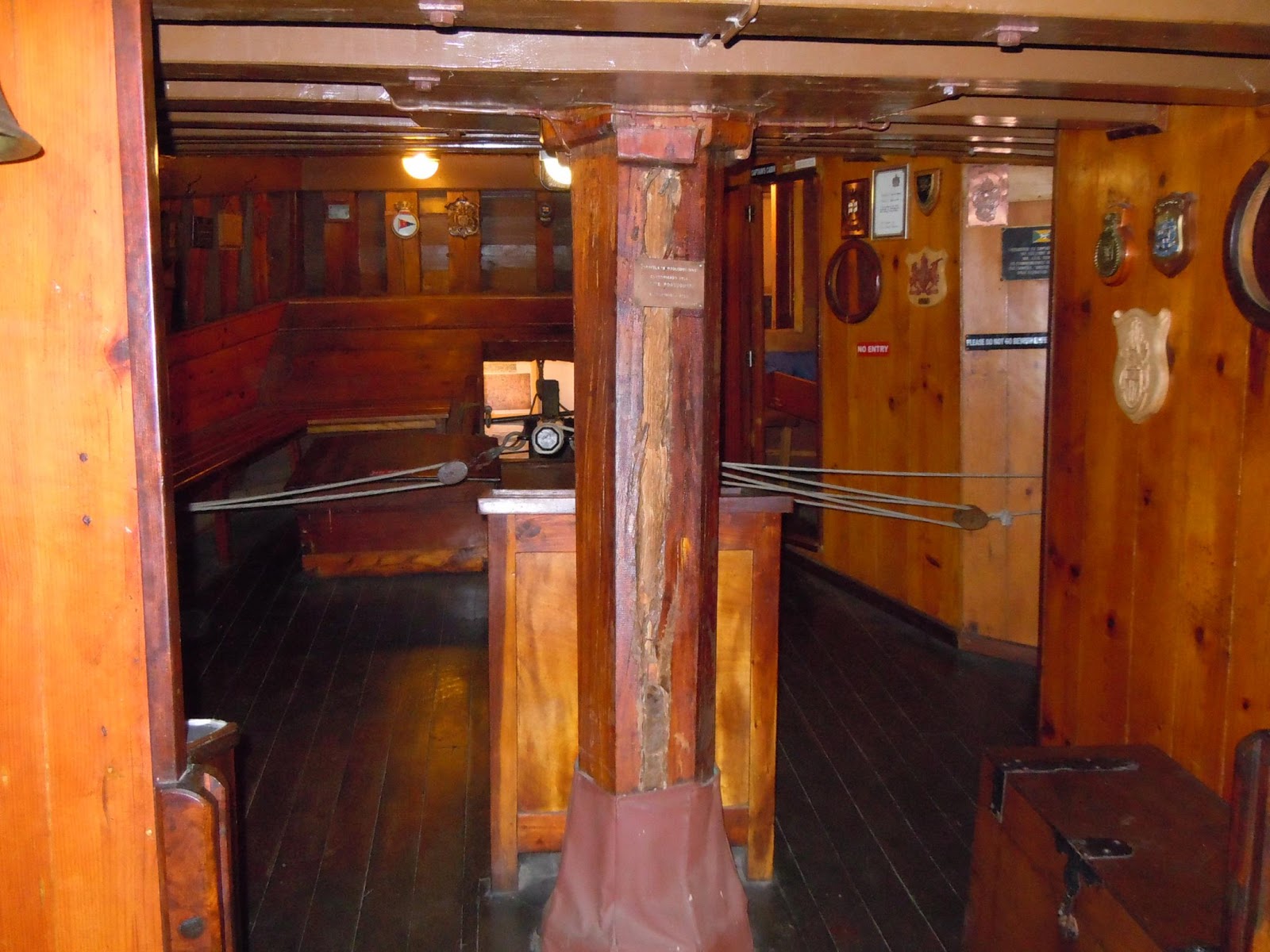
We popped into the Dias museum next door to the hotel. Bartolomeu Dias, a Portuguese nobleman and explorer, in 1488 sailed around the southern tip of Africa, being the first European known to have done this. On the 3rd of February that same year he landed at Mossel Bay, calling it Aguada de São Brás, meaning the Watering Place of St Blaize. In the 1980's, this event was re-enacted with a replica caravel sailing from Portugal to Mossel Bay. The replica was put in the Dias Museum near the post tree. The post tree was a tree under which sailors and explorers left messages to other ships passing. The first being Pedro d'Ataide, when landing at the same spot Dias used to get water, left a message in a shoe with the account of a storm in which he lost a large part of his fleet. The tree was used as a makeshift post office for several decades thereafter. This tree is still standing and you can send mail from a boot shaped post box underneath it.
 |
Sorry mate, the ships not due for another couple of months.
|
The caravel was really small. I was surprised that this small ship was used to sail into uncharted waters. Obviously several of them were used, but still. You can go inside the ship. It's a bit more modern inside as it was actually used to take 17 people from Portugal to South Africa. Still, it was very basic.
 |
The replica of the Portuguese caravel in the Dias Museum.
|
 |
The deck has a really heavy slope. I can't imagine having to walk around on it during heavy weather. I'm not an ocean person by any means.
|
 |
I'm given her all she's got, Captain!
|
 |
The rudder (middle, behind beam) and Captain's quarters (to the right of the beam).
|
 |
Sleeping quarters. Pretty cramped, I can tell you that.
|
 |
The caravel from the rear.
|
 |
Some of the messages left by Dutch explorers.
|
We went for a beer at Cape St Blaze, watching the weather pick up and push the tide in against the rocks. Quite a spectacular view from the restaurant.
 |
Great swimming spot, but just metres away from a very rough sea.
|
After this we went back to the bungalow and started the fire to braai (BBQ) the massive steaks given to us by the neighbours. They even gave us the firewood to do so! The steaks and a bottle of red made for a good, relaxing night. We even had a visitor in the form of a cat. She hung around, even after we went inside later that evening. A real little attention seeker, but I think probably just after a piece of meat scraps.
 |
Our little guest for the evening.
|
Tomorrow it's the last leg of the trip.
Day 12
Mossel Bay to Oudtshoorn
Last day! Hard to believe, but it's pretty much all over after today. We're heading out to Oudtshoorn for a relatively short day of riding, but it should be interesting nonetheless. We didn't know what to really do today as the original plan to go across the Attakwaskloof Pass was given a blow after we found out it's a 4x4 track and we kept getting mixed reports on what it's condition and grade is like, so to be safe, we dropped it from the itinerary. I don't want to get stuck out there on the mountain on the last day.
And so we double back on the road we came in on, but only until we get an unsealed road connecting us to the R328 to Oudtshoorn. We could have just jumped onto the sealed R328 directly from Mossel Bay, but we got our signals mixed that morning and ended up back onto the R327. Anyway, we were on the right track again and heading over the Robinson Pass towards Oudtshoorn. The pass is great. Again, pretty fast, fairly good condition road surface (all sealed) and it wasn't too busy. The bikes had more than enough poke to deal with whatever traffic there was on the pass. Sheer drops on the western side of the pass down into ravines hundreds of metres down. Beautiful views though.
Down the other side and and only about 10 or so kilometres down the road we turn onto an unsealed road heading towards Calitzdorp. It's not marked on my hard copy map, but Brien has it on his GPS. It should take us across the Gourits River, over the Rooiberg Pass and at some point past the Gamka Nature Reserve, into Calitzdorp from the south.
 |
Beautiful Karoo scenery as we trek across the back roads towards Calitzdorp.
|
 |
We cross a small little pass, not even marked on our maps.
|
 |
The roads are great. An absolute pleasure to ride and I enjoy making the bike's back wheel break away here and there.
|
 |
Sweet thorn trees line the sides of the road. You don't want to end up in these. Well, the wildlife feast on these, so they can't be that sharp. You try it out next time and tell me whether I'm right.
|
The road was generally in a good condition. We got about 5 or so gates to open and close as we went through several farms. Here the road condition varied, but nothing challenging. I don't know whether it's just us getting more confident on the 800's, but patches of sand and loose gravel don't worry me anymore and I actually start playing around with a bike a bit more, opening it up in the sand so the back end starts breaking away. On loose gravel I weave from track to track on purpose so that the back end looses traction and breaks away. Great fun. Hey, you get bored sometimes!
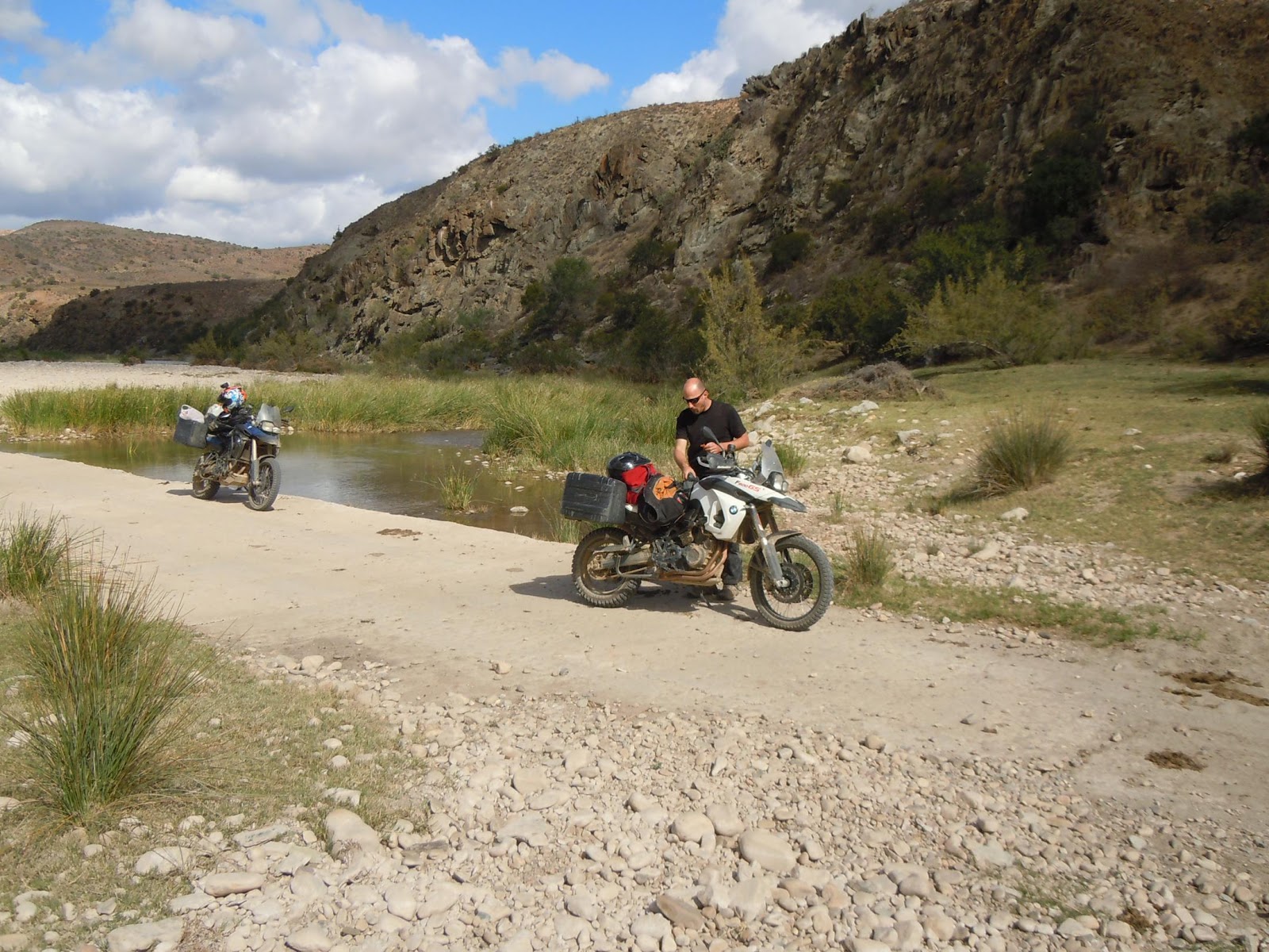
We reach the Gourits River, although, I think it is. It might be called something else at this point, but I'm not sure. The crossing is something we haven't had before. Just a whole load of round river bed rocks, then onto a concrete bridge. Brien's taken the lead as we don't want the camera to get full of dust if I'm in front. He's stopped on the other side of the river to take a video of me crossing. Luckily I handle it well and don't make a fool of myself on video. It's a great spot to stop and take a breather, have a bit of water and some dried fruit. It's a beautiful little valley. The sound of the river's quite calming.
 |
The Gourits River.
|
 |
Time for a breather.
|
 |
A great spot and we take our time here.
|
 |
On the other side is a whole lot of river rocks. Tricky, but good fun.
|
The road climbs steeply out the other side and we keep following the farm roads until we join the unsealed road connecting Vanwyksdorp to Calitzdorp heading over the Rooiberg Pass (Red Mountain Pass). The pass is good fun. It's like a jeep track in good condition. We stand up all the way up, taking it at a slow pace, but opening up in sections just to have some fun. It keeps climbing up the hill and the view just continuously improves. Low hills as far as you can see and at the back the Outeniqua Mountains.
 |
Heading through some farms, opening and closing gates as we go along.
|
 |
Great vantage point out over the hills. This is just before we get to the Rooiberg Pass.
|
We go past the Gamka Nature Reserve and start dropping down the other side of the pass. Here the pass has some old stone walls along the road edges as the drops are steeper. The corners are corrugated, so we find it difficult to stop the bikes as we approach the corners, sometimes having to go wide.
 |
Just before we get to the Rooiberg Pass.
|
 |
Hills and mountains as far as you can see, in all directions.
|
 |
I'd love to have a farm in this area. Just look at that. Brien's the dot on the road in the middle there.
|
 |
I almost lost it on the other side of that corner as the ABS kicked in and didn't want to let me stop.
|
 |
Last stretch to Calitzdorp.
|
The pass ends in a picturesque little valley dotted with some farm houses and sheds and eventually leads out onto the road into Calitzdorp
You know, I've lived in this region most of my high school life, but I've never seen this part of Calitzdorp. It's the first town on the way to Cape Town, from Oudtshoorn and we always just pass through the main street as you don't stop at the first town and when you come back you don't stop as you're almost home. The main street isn't much to admire, so I don't blame people for thinking it's a dump. Take a moment and turn down on the roads and head into the residential areas. You'll be surprised. We stop at the nicest little coffee shop, have a coffee and take a look at the gallery next door, where we see some beautiful artwork. The artist's name is Marinda Combrink. She has a series called 'Toffee Apple Glamour Girls', which are the 1940's and 1950's glamour girls painted with a slight modern touch. I loved it. She also has a lot of portraits of people from Calitzdorp. Small and just faces and she's planning to do as many as possibly.
 |
The restored general dealer. One of the first buildings here in Calitzdorp.
|
 |
Nice spots outside to just put your feet up and relax with a snack and a coffee. The original old tin adverts on the walls are great.
|
 |
We're not allowed to play on the billiard table though. Bummer.
|
We wrap up here and head out to Oudtshoorn along the R62, the Karoo's most famous road. It's only about 30 kilometres and so quickly, our trip comes to an end.
 |
Last stretch of road before we get to Oudtshoorn.
|
It's the Klein Karoo Arts Festival this week and the town is insanely busy with people and cars. I almost get knocked over by a guy in a Mercedes when he changes lanes without looking. 12 days without incident and I almost have one 5 kilometres from the end. Like Brien said, the most dangerous bit is the final 5km.
 |
Happy to see my wife and daughter, but disappointed that the trip is over.
|
Tomorrow we take the bikes back to George and we plan to head over the Montagu Pass, instead of taking the sealed road. It's difficult to choose as the sealed pass is also great to ride, but we're on adventure bikes after all.
Day 13 - Returning the bikes
Oudtshoorn to George
Yes, today it's pretty much all over, but we have a couple of hours more of fun with the bikes as we still need to return them to Lynn Schroeder BMW in George, so I choose to take us over the Outeniqua Mountains via the Montagu Pass. The pass was completed in 1847 by Henry Fancourt White, and Australian road engineer, using convict labour...I think there's something familiar in that sentence...
The weather looked a bit iffy around the mountains as we left Oudtshoorn. You can see them in the distance as George is only about 70km from Oudtshoorn. Taking the turnoff at Herold on the Uniondale road, we started the pass. It's a great bit of road and incredibly scenic. Brien was worried it might get a bit tough as he didn't come prepared for it, thinking that we were only dropping off the bikes and not putting any socks on or taking any liners for his pants. The weather luckily cleared and the ride was really easy. Quite narrow for a car, but great with the bikes. We took it nice and easy, taking in the scenery and fresh air. A lot of the corners have names and refer to some event (e.g. Amanda's Grave) or a structure that used to be situated there (Old Smithy where the blacksmith was). This is quite a popular road for bikes and I well recommend it as it's something bikers from all skill levels can tackle. Make the effort to do this one!
 |
You criss cross under and over the rail tracks initially, until it takes its own path higher up the mountain and the road starts snaking down into the valley.
|
 |
The road snakes down into the valley below.
|
 |
Slight drizzle at times, but nothing of concern. It made for beautiful scenery at least.
|
 |
Several bridges dot the road. None originally constructed when the pass was built by
|
 |
Keur River Bridge, a national monument.
|
Finally we reached George and had to hand over the keys. I got slapped with the bill to repair the rim and Brien got away with it as his bike is second hand. Bad luck, but hey, I wasn't going to let that dampen my spirits.
So the fat lady has sung. It's over. Until next time.

A great trip and and loads of fun. I can't wait for the next one up to Namibia and Botswana!! :)
No comments:
Post a Comment